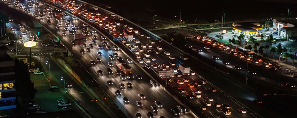
After a long day at work, you probably want to get home as soon as possible. But, on most days, that’s easier said than done.
Today, commutes across America are longer than ever – and they’re increasing. The average American commutes 52 minutes to work each day, for a total of 4 hours and 20 minutes per week. Think of all the productive ways you could be spending that time, rather than sitting in your car or crammed in a crowded subway.
In our last blog about commutes, we explored where some of the longest commutes to work are in America. Now, let’s learn more about why areas have long commutes and how Big Data can be used by transportation planners to help mitigate this problem
Why Some Commutes Across America Are So Long
So, why are commutes to work long? There are a number of factors. First, there are large population concentrations in the suburbs. As the cost of living in city centers increases, people relocate to the suburbs, which means they often have to commute into the city for the best jobs.
Next, due to urban and suburban development, construction is a regular feature of many people’s daily commute. Doesn’t it seem like there’s always something under construction in your area? Because commutes are increasing, roads need to be reconfigured to accommodate more people. And, there’s the regular construction to upkeep roads, too.
Solo commuting plays a role, as well. Most commuters today don’t carpool, choosing the freedom that comes with driving their own car to or from work. Over 90% of trips to work happen in cars, which equates to more cars on the road and slower commutes.
How Data is Collected
Each minute, millions of mobile devices collect data points that can hold valuable insights for transportation companies or urban planners. But, this raw data collected from phones, tablets, or GPS devices can be hard to translate into actionable transportation plans. So, you need a partner like StreetLight Data to help. StreetLight Data is a technology company that transforms Big Data from mobile devices into actionable analytics for transportation infrastructure and policy planning.
Using a solution like StreetLight Data’s StreetLight InSight® platform helps because it collects and condenses all of the data resources alongside processing software in one easy-to-use tool. You save time by not going out and finding the best Big Data resources yourself from different vendors, or by trying to organize and analyze data yourself outside of a proven framework.
Once the raw data is collected, it’s processed and presented as a number of different, customizable and insightful analytics to users. These analytics includes:
- Origin-Destination Matrices
- Traffic Diagnostics
- Corridor Studies
- Trip Purpose
- Demographics
- Average Travel Times and Travel Time Distributions
- 2016 AADT (Average Annual Daily Traffic)
- Commercial Truck Studies
How Data Helps Shorten Commutes
While the data collection process may seem intricate, the results it produces can be applied to a number of different transportation modeling, forecasting, and planning activities. And these activities can help you design better project and policy solutions that reduce – or even eliminate – long commutes for citizens. These include:
- Creating and calibrating travel demand models
- Evaluating before-and-after studies to determine project impact
- Prioritizing tasks and creating cost/benefit analyses for projects
- Busting congestion
- Routing detours
- Designing, expanding, and analyzing public transit systems
- Changing toll systems and signals
- Employer incentive programs
- Acting as supporting materials for public meetings and communications
Each of these transportation projects could help improve commutes in your area and shorten the drive for millions of Americans. With the right data insights, you can pinpoint exactly where problem areas are, the factors behind those problems, and the solutions that can help address these issues.
The Road to Becoming a Transportation Rockstar
Transportation data can be used by a number of transportation professionals, both in the public and private sectors. Here’s how data ensure you and your team successfully shortens traveling commutes.
How Transportation Planning Consultants Can Improve Projects Using Big Data
The success of private transportation firms is dependent on completing projects effectively and efficiently. With transportation analytics, you have the insight needed to properly plan and execute your projects. You’ll also be able to find creative solutions that could act as a competitive advantage over other firms bidding for the same projects. Plus, data can provide insights to show the return on an investment in your projects, like how building toll roads can shorten commutes.
How Public Sector Planners Can Improve Commutes for the Community
No community is like your community. Big Data helps you find the precise solutions you need to shorten traveling commutes, like improving your public transit system and first-mile/last-mile solutions, implementing new carpooling programs, and designing active transportation infrastructure.
One concern you may have as an urban planner is that the steps you take to improve commutes might not solve the problem. In the past, without data in your corner, this was a definite possibility. Today, when you use data, however, you can mitigate that risk by being sure of the factors that impact commutes. Even better, you can easily measure project performance as you implement different solutions and adjust your strategy to optimize results.
What the Government Can Gain by Using Big Data for Commutes Across America
For the federal government, data is essential for comparing commutes nationwide. This helps the government pinpoint areas that might need more federal funding for road projects or to improve public transit systems.
Data is also beneficial when it comes to nationwide initiatives. For example, the U.S. Green Building Council was able to use Big Data for transportation to better characterize commute distances.
If you’re ready to cut down on commutes in your community, it’s time to turn to Big Data. Get the analytics you need to understand the factors behind long commutes in your area and develop effective strategies to address these challenges. With StreetLight Data on your side, you’re sure to translate Big Data analytics into performance-driven results.

