
From Preset to Personalized: Using Transportation Zones in StreetLight InSight®

Transportation zones are the building blocks for transportation studies. Choosing the best zones for each analysis can help a project stay on budget and on time, and with fewer inputs — an efficiency strategy that’s even more important in today’s world of increasingly unstable transportation resources.
In this “how-to” guide, we share details on different ways planners can use the transportation zones in StreetLight InSight®’s visual platform.
Create a Zone Framework
Choosing a zone set depends on many factors, not just matching the geographical area of study. We recommend creating a framework in order to efficiently balance your time, resources, goals, and more. For example, how much expertise and time does your analysis team have? Is the analysis area unusually small or large? Do you have access to an existing zone library?
Knowing the parameters up front, and choosing zones accordingly, can ensure you get the results you need while saving resources in both configuration and processing.
Move Faster With Preset Zones
Choosing from already prepared zones is the fastest and easiest way to start an analysis. To help you move quickly and get to results, StreetLight InSight® offers some common options in our preset zone library: zip codes, traffic analysis zones (TAZ), Census block groups, and road segments based on OpenStreetMap (OSM).
Preset zones are easy to work with, and particularly effective for government agencies and private industries, which tend to study movement trends across entire regions rather than specific corridors or neighborhoods.
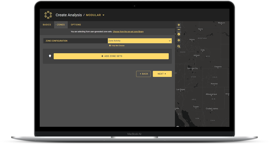
Figure 1: StreetLight InSight® users can choose between preset or personalized zones when beginning an analysis.
Zip Codes
Zip code zones are relatable geography for public-facing and private industry uses. This is the largest preset zone set in our transportation zone library, so an analysis using zip code zones can create a “blanket” visual for a region.
Traffic Analysis Zones (TAZ)
TAZ sets are commonly used for populating travel demand models. Uploading a predetermined TAZ set can save time for modeling, and enable modelers to adjust the data set by adding or removing zones, and refresh the model easily.
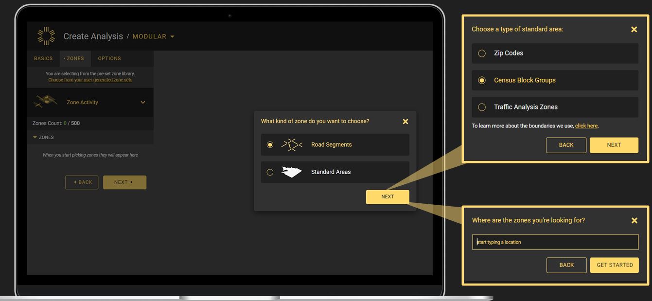
Figure 2: Preset zones in the StreetLight InSight® library include zip codes, Census block groups, traffic analysis zones, and road segments.
Census Block Groups
Because Census data includes demographic information, this is the most useful zone set for environmental justice and Title VI analysis. These are the smallest zones in our predefined sets, so they create the best granularity.
Road Segments
Road segments based on OSM show specific roadways to inform analyses including corridor studies. Get right to the important data for that segment, including hourly volume and traffic distribution, or annual average daily traffic (AADT) for all roadways in a certain area.
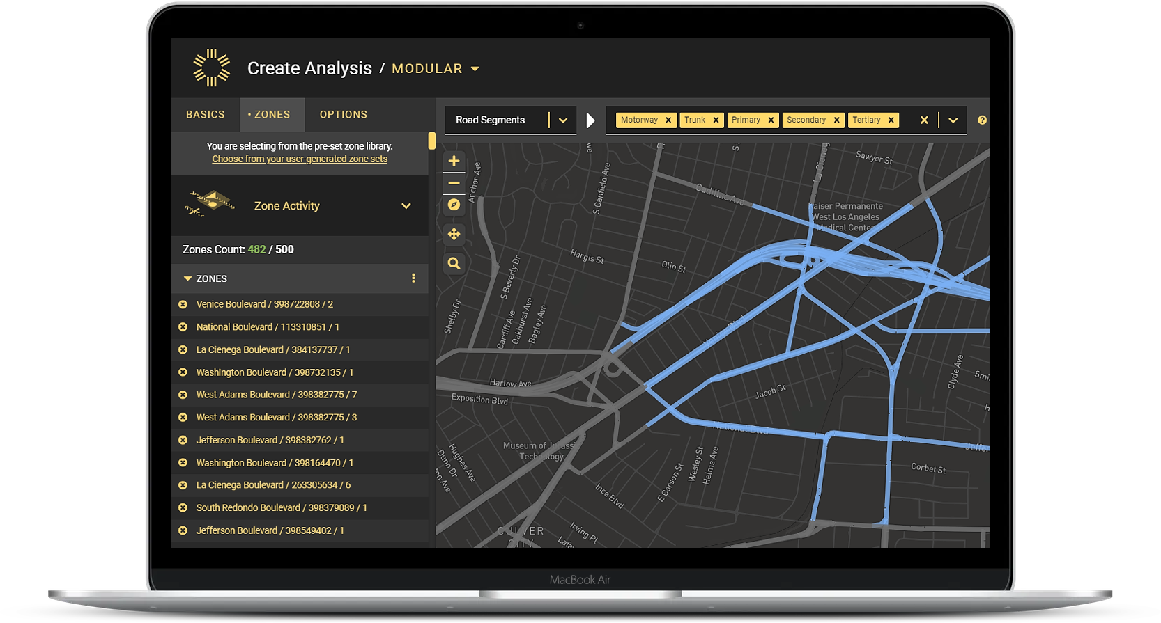
Figure 3: A sample analysis looks at preset road segment options in Los Angeles.
Go Deeper With Custom Zones
StreetLight InSight® also offers the capability to upload or create completely customized zones and zone sets. Customized transportation zones allow analysts to study any area, or compare groups of areas, with powerful granularity.
For example, users can upload a set of zones they’ve already built — like all the parks or shopping centers in a region. Users can also draw their own zones right in the platform — like the travel shed for a transit stop, neighborhoods likely to be affected by a special event, or low-income neighborhoods.
This flexibility is useful for several types of applications, including:
- Getting the most recent data. For example, TAZs are updated frequently, and sometimes uploading a zone set straight from a municipality will ensure the most recent zone boundary data.
- Drawing custom zones to highlight a specific neighborhood that isn’t encompassed by a single zip code.
- Micro-level studies and traffic impact analyses that focus on specific types of locations, like shopping centers, hospitals, or sports arenas.
- Private companies, like ride-sharing and other private transportation companies, working with square or hexagonal grids, which requires creating manual zones.
- Real estate agents with parcel-level information for where their properties are located.
Maximize Power With Zone Combinations
Having access to both preset zones and more customized options in StreetLight InSight® creates far more flexibility.
For example, government agencies often work with engineering or architectural firms on specific projects. The engineers can dive deep on modeling with custom zones, while agency planners can run a parallel analysis for public reports using Census block zones.
Likewise, a private company may want to model travel demand for a neighborhood surrounding a specific event or destination, but then share additional information with city officials used to studying affected areas by zip code.
Having access to multiple zone sets, including a choice of preset and customized, means that you can optimize each project as needed. Leverage the right zone set-up to maximize your transportation planning efficiency.
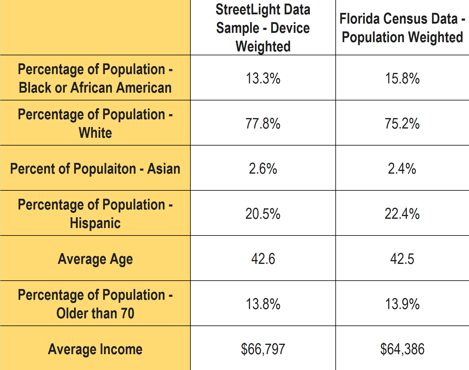
What we see in our data is that our sample for Florida closely represents the population at large. Another promising proof point that our data reflects the diverse characteristics of the geographies that our customers analyze with StreetLight. Lastly, it bears repeating that any metric that is expressed as StreetLight Volume has been normalized for any local bias or sampling variation.
Going Further: An Invitation to Explore Our Data
We’ve provided the “bird’s eye” view of our sample’s representativeness in Florida, and we also want researchers and analysts to understand how that plays out when the data is converted into StreetLight Metrics.
For more detail about the methodology and validation supporting our analyses, we invite you to explore our various white papers, and in particular Our Methodology and Data Sources.
1Note – the current StreetLight Indices for bikes, pedestrians, and trucks do not use the Census penetration for normalization, both use other grounding data instead. See the full documentation for details.