
Introducing StreetLight InSight® Integration with Esri’s ArcGIS to Power Innovative Transportation Solutions

We are continually impressed with the new and innovative ways StreetLight’s customers apply StreetLight Metrics to help solve transportation challenges. And as customers look to integrate StreetLight’s Metrics with other planning software, Esri’s ArcGIS stands out for the value customers get from its geospatial mapping, visual storytelling, and use in public sharing of mobility data.
Now, to better serve our customers, we are enabling integration between StreetLight InSight® and ArcGIS, allowing users to easily export their StreetLight InSight® analyses into their ArcGIS workflows in a few clicks. As an active member of the Esri Partner Network (EPN), we’re excited to see users of both platforms leverage the full power of StreetLight Metrics in their ArcGIS applications as Hosted Features layers.
Below check out some of the ways StreetLight customers have previously used our Metrics in ArcGIS applications.
An AADT Map Viewer shows the power of StreetLight & ArcGIS in action
The Indian Nation Council of Governments (INCOG)’s AADT Map Viewer offers a compelling example of the power of StreetLight Metrics in concert with ArcGIS. As part of their responsibilities, the INCOG in Tulsa, OK owns and maintains a publicly available online map that provides AADT counts. Developers, business owners, county officials, city planning departments, and others access the map to obtain standard AADT traffic counts.
“Historically, the various jurisdictions in the Tulsa area provided AADT counts to INCOG. However, due to high costs, many jurisdictions stopped collecting traffic counts, creating data gaps. INCOG turned to StreetLight to fill this gap and then used ArcGIS Mapviewer to visualize StreetLight AADT metrics.”
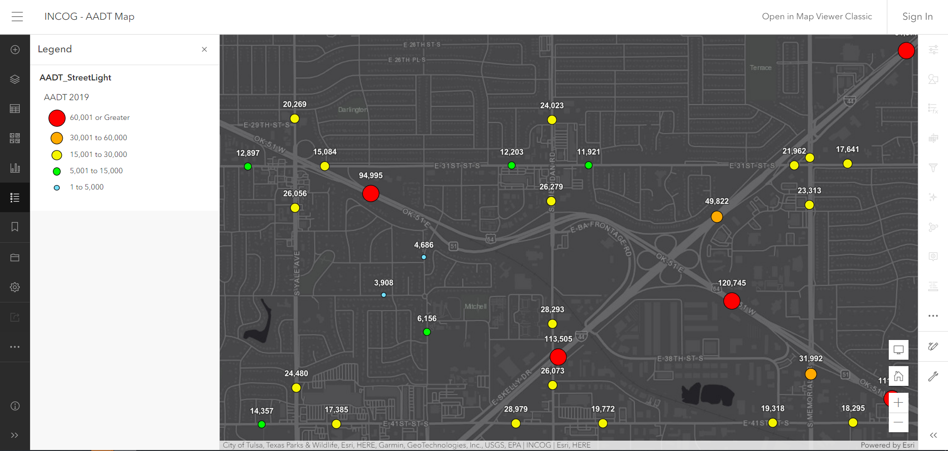
INCOG’s AADT Map Viewer using StreetLight’s Metrics in the ArcGIS platform
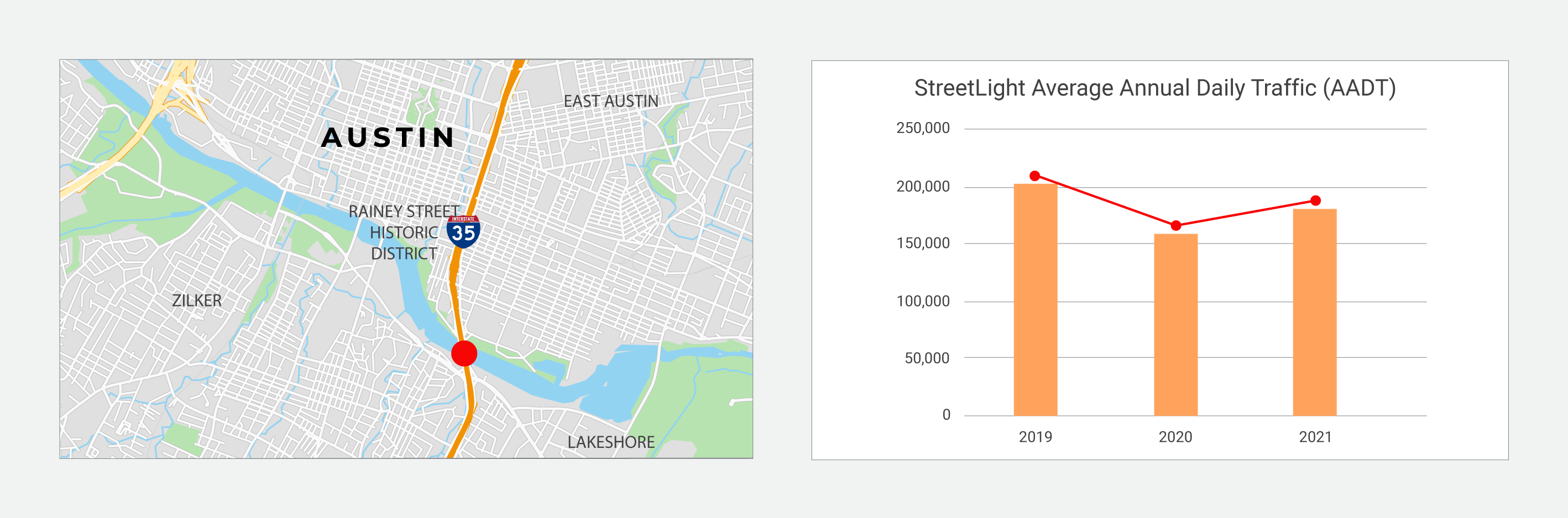
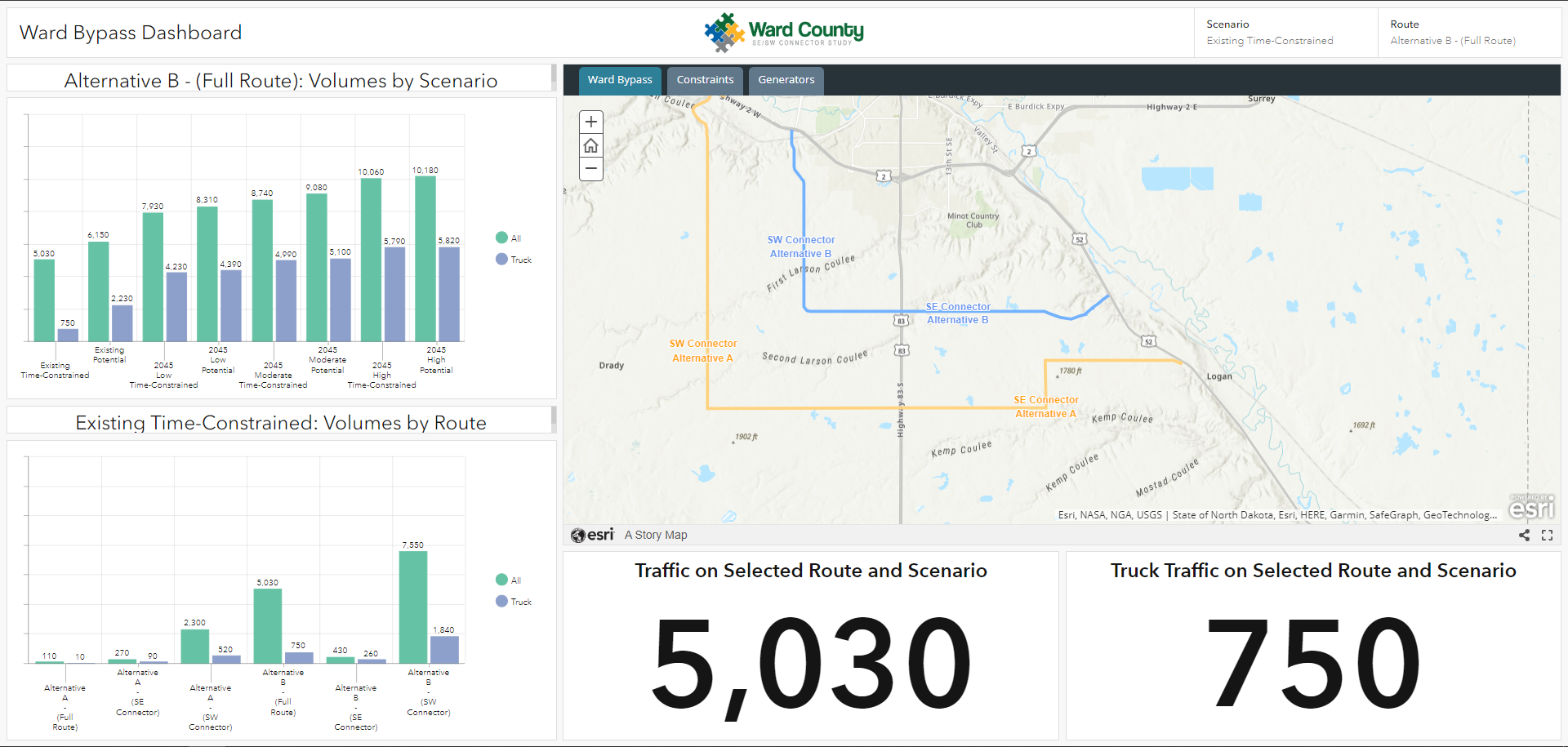
How Streetlight & ArcGIS support new route alignment analyses
Consulting firm Bolton & Menk turned to StreetLight Metrics and the ArcGIS Dashboard for its SE/SW Connector Study. This study involved analyzing potential new route alignments to improve accessibility to a new hospital, improve freight reliability at the convergence of three US highways, and reduce bottlenecks through the heart of Minot in Ward County, North Dakota.
Using an ArcGIS Dashboard with StreetLight Metrics, the Bolton & Menk team was able to integrate StreetLight traffic and travel time Metrics to explore historical travel activity by time of day and illustrate major barriers to routing opportunities, and contrast hypothetical speeds to estimate benefits.
A closer look at how other regions can generate traffic insights with StreetLight’s platform
StreetLight’s ArcGIS export tool will initially support the following StreetLight InSight® analyses: Zone Activity, AADT, and Segment Analysis. Access to this new StreetLight functionality will be available to all StreetLight InSight® users under the ‘Actions’ dropdown in the StreetLight InSight® Analyses tab.
See below for a demo of how to use the new StreetLight InSight® integration with ArcGIS when it will be available next week.JTNDaWZyYW1lJTIwd2lkdGglM0QlMjI1NjAlMjIlMjBoZWlnaHQlM0QlMjIzMTUlMjIlMjBzcmMlM0QlMjJodHRwcyUzQSUyRiUyRnd3dy55b3V0dWJlLmNvbSUyRmVtYmVkJTJGc3d4MDdCNkF4djglMjIlMjB0aXRsZSUzRCUyMllvdVR1YmUlMjB2aWRlbyUyMHBsYXllciUyMiUyMGZyYW1lYm9yZGVyJTNEJTIyMCUyMiUyMGFsbG93JTNEJTIyYWNjZWxlcm9tZXRlciUzQiUyMGF1dG9wbGF5JTNCJTIwY2xpcGJvYXJkLXdyaXRlJTNCJTIwZW5jcnlwdGVkLW1lZGlhJTNCJTIwZ3lyb3Njb3BlJTNCJTIwcGljdHVyZS1pbi1waWN0dXJlJTIyJTIwYWxsb3dmdWxsc2NyZWVuJTNFJTNDJTJGaWZyYW1lJTNF
“The government should look for solutions that not only mitigate the gas tax shortfall but also create an equitable fee structure that doesn’t overburden drivers in disadvantaged communities.”
StreetLight looked at public data and our own metrics for VMT by county and income band in order to analyze a road usage tax in Colorado, which is considered one alternative to gas taxes, to see how it could impact people across two demographics groupings — income and geography.
Below we look at:
- The equity questions policy makers must ask
- How a VMT tax would impact drivers, by income
- How a VMT tax would impact drivers, by geography
How a VMT tax would impact drivers, by income
We used data from the most recent National Household Travel Survey (NHTS) and StreetLight’s own Metrics in order to determine how a shift to VMT tax may affect drivers in Colorado. We analyzed these results by income level and geography in order to investigate whether any groups would be disproportionately affected.
First, we calculated the amount that drivers pay under the gas tax, versus how much they would pay under a VMT tax. For costs, we used the current state gas tax for Colorado ($0.22 per gallon) and the VMT rate used in Colorado’s Road User Charge pilot program ($0.012 per mile). To turn this into household-level expenditures, we used 2017 NHTS data about individuals’ vehicle type, fuel efficiency, annual mileage1, and income. Results are shown below:
1 We used the “BESTMILE” statistic in NHTS. This is the best-available estimate of each household’s mileage, based on odometer readings,
 self-reported VMT, and/or travel miles on a given day.
2 There are additional outliers which exist beyond the range of the y-axis on this graph. They are not shown due to space constraints.