
From Multimodal to Omnimodal: Living Today’s Transportation Reality

After nearly 6 years at StreetLight Data, my transportation nerdiness is firmly cemented. Every time I take a trip, I research the various modes of transportation available to reach my destination, then carefully plan my itinerary. Frankly, I enjoy the challenge of combining modes in the most efficient way possible. Trip-planning smartphone apps like GoogleMaps are simplifying this process for non-transportation nerds, too. For me, the most efficient mode of travel generally means the fastest, but carbon emissions contributions and cost are always important considerations as well.
My personal multimodal challenge was elevated to a new level on a recent trip that combined business travel for a customer training with personal travel for a family wedding. Not only were these two locations in different states (neither of which I live in), but the wedding was somewhat of a destination, and it was not terribly accessible for visitors from far away. In this article, I’ll use my travel experience to illustrate how today’s journeys can quickly become so multimodal that you might even call them “omnimodal.”
Trip One: Walking, Bus, Plane, Taxi
The journey began on a Wednesday on a beautiful spring day in Boulder, Colorado, where I live. I’m lucky that my city offers frequent regional bus service to and from Denver International Airport, which is just over 40 miles from Boulder. In the morning, I grabbed my rolling suitcase and walked about a half mile to a bus stop to catch the regional service. The sky was blue, birds were chirping, and daisies were in full bloom after a week of rain.

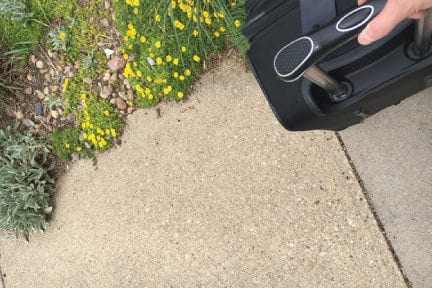
Mode of Travel #1: My walk to the bus station
Within an hour, I was at the airport without battling traffic or dealing with parking. And with the bonus of having time to catch up on some work while on the ride. As a frequent traveler, I cruised through airport security. Before long I was boarding my flight to New York City. The mobile office work continued on my flight east thanks to airline WiFi. I was even able to run some analyses in the StreetLight InSight platform ahead of my visit with StreetLight Data’s client, the New York City Department of Transportation (NYCDOT) on the following day.
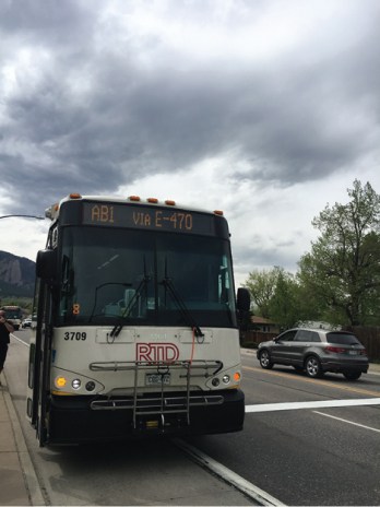
Mode of Travel #2: Regional Bus
My flight landed on-time at La Guardia airport and I exited the terminal to catch a yellow cab taxi to my hotel in Manhattan. I often hail Lyfts at airports, but catching rides from transportation network companies (TNCs) can be tricky at La Guardia. By this point, I was beat after the first leg of my multimodal journey, so I headed straight to bed.
Trip Two: Walking, Subway
The next morning I awoke with the energy that I love about NYC! I strolled to a nearby café for breakfast and then walked a few blocks to the main office of NYCDOT on Water Street. If my hotel had been further away, I would have considered renting Citibike (that’s one of NYC’s bike share options) or calling a Lyft, but it wasn’t necessary. After a fruitful day of training new users and discussing use cases with the NYCDOT team, I was ready to start the “personal” part of my trip.
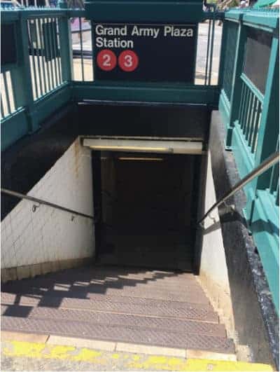
First, I returned to the hotel to fetch my suitcase by foot and then walked a few blocks north to catch the subway on Wall Street. No matter how many times I visit NYC, there is always something exiting about being on one of the most famous streets in the world. From there, it was a short ride under the East River into Brooklyn, where I met up with an old friend and stayed the night.
Trip 3: Walking, Subway, Amtrak Train, Personal Vehicle
Friday morning was one of those perfect NYC spring days, and I knew I was lucky to catch this weather before the summer humidity sets in. After another quick walk back to subway, I was back underground heading west towards Penn Station in Manhattan.
Mode of Travel #5: NYC Subway
Upon exiting the subway at Penn Station, I remembered once again that I’m glad to have lived in NYC previously. It means I still somewhat know my way around. Signs for street exits, other subway lines, and multiple train systems pointed in every direction. I knew I needed to find Amtrak, so I started down the corridors, passing underground stores and restaurants that sometimes make me feel like I’m in a futuristic subterranean city.
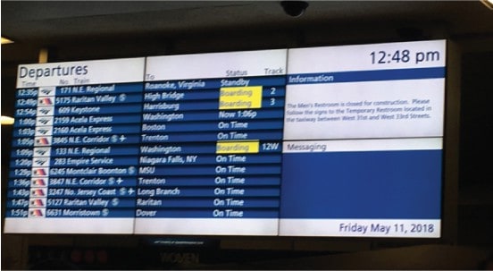
I finally emerged in the large atrium for Amtrak, where dozens and dozens of travelers were watching the “switchboard” to find out the platform where their train would arrive. I was hopeful that the board would still actually switch over the numbers for each new train. (Fellow transportation nerds: That’s called a “mechanical split-flap display.”) Alas, the sign has been digitized, but it still felt like something from another era. I took a moment to take in the scene: Business travelers heading home from NYC meetings, mixed with families heading out of town for the weekend and tourists adorned in “I Love NYC” shirts heading back to their homes. I was just waiting for a “Mad Men” character to show up.
My Acela Express train finally arrived, and within a minute I was surging with the crowd towards the tiny escalator to head down to the boarding platform. With open seating, I found the closest seat once I boarded and the train pushed off after a few minutes. It was only then I realized I would be facing backwards for the ride, so I was grateful that I rarely get motion sickness.
Mode of Travel #6: Amtrak Acela Express Train
Once again, I was able to experience a true mobile office with the Amtrak WiFi. This made it possible to catch up on email and even have a few instant messaging conversations on Slack with my colleagues back in California. Before long, the train pulled into the station at Wilmington, Delaware. The approximately 130 mile journey only took an hour and a half – probably faster than driving and definitely more comfortable, as anyone who has battled traffic out of NYC and along the New Jersey turnpike can attest!
The final leg of my multimodal journey was now ready to begin. This one required a good old-fashioned car rental.Fortunately, there are a few car rental agencies with offices inside the Amtrak station in Wilmington. It only took a few minutes to get the contract paperwork signed and walk across the street to the lot. And then I was settled into my Toyota Yaris rental car, a favorite for the ultimate fuel-efficient rental, and on my way to Rehoboth Beach. I was early enough in the day to beat the weekender traffic and arrived at the beach with plenty of time to kick off the wedding celebrations, and stop by Grotto’s for a slice of their famous pizza!
Over the course of 48 hours, I managed to travel about 1,800 miles from my house. It only took a bus, an airplane, a taxi, a subway, a train, and a car – plus a bit of walking too. For those counting, I hit seven modes of travel before I even started my trip home. Perhaps the only big thing I missed was a ferry. If my #1 goal was maximizing the number of modes I took, I could’ve jumped off the train in New Jersey and rented a car so I could take the Cape May ferry to Lewes, Delaware!
Grotto Pizza: My reward for a truly multimodal journey!
From Multimodal to Omnimodal
Taking different modes of travel is easier and more convenient today than ever before. All it takes is a few taps on a smartphone for travelers to identify the most efficient mode, whatever that means to them. These advances are making multimodal travel the most convenient option for many journeys – even those with fewer legs than my whirlwind of an omnimodal adventure.
That’s why I’m so enthusiastic about StreetLight Data’s Multimodal Measurement (M2) Initiative. It’s all about measuring and analyzing all of the different modes of travel and how they interact. With journeys like mine becoming more common and accessible, it’s critical that transportation planners can access real-world data about these trips, including the modes used. Origin, destination, and route are simply not enough. To learn more, check out our blog article on our Multimodal Measurement Initiative.