Full story originally published by Bloomberg News on August 22, 2019.
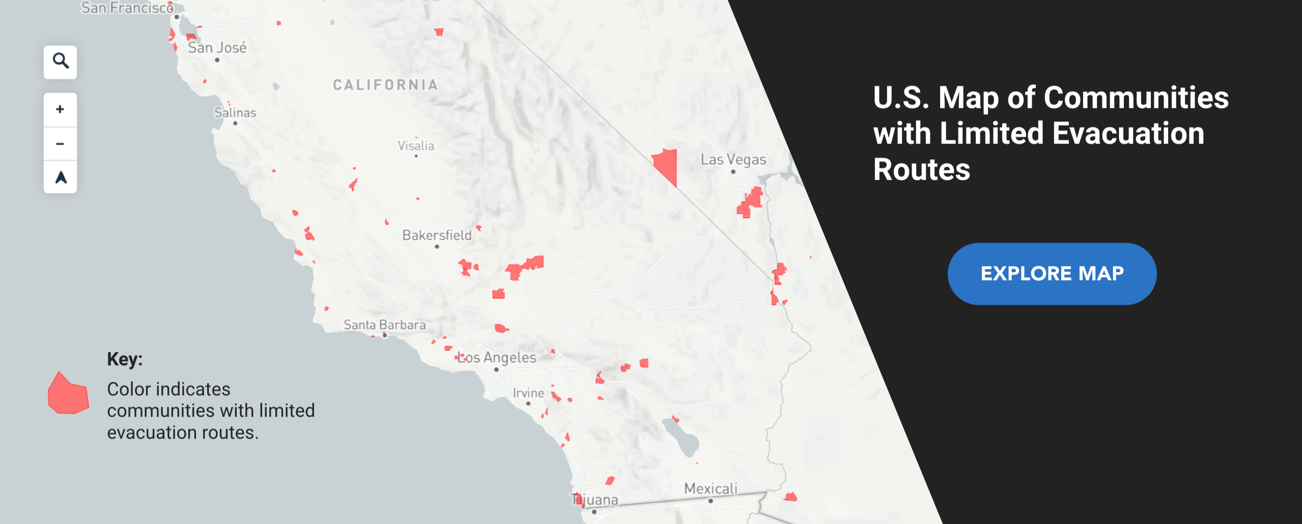
In an effort to help towns across the country better prepare for disasters requiring evacuations, StreetLight Data shared the results of a nationwide analysis of the top 100 communities with limited evacuation routes.
Bloomberg reporter Jeff Kearns interviewed StreetLight CTO and analyst Paul Friedman and CEO Laura Schewel about the report.
Kearns noted that the report comes as California enters wildfire season with officials still recovering from the deadly Camp Fire last year, and amid the east coast’s Atlantic hurricane season.
Evacuation-route risk can apply to floods, fires, dam breaks, hurricanes, tornadoes, and other emergencies. Communities and towns with limited evacuation routes can face challenges in getting residents to safety before a disaster hits.
The evacuation-route study analyzed 30,000 U.S. areas with populations under 40,000.
Evacuation-route risk was determined by what percentage of the area’s population uses one main exit for daily vehicle trips, factoring in the number of other potential exit routes. For the areas with highest risk, a large percentage of drivers use only one evacuation route although others may exist (including highways, roads, dirt roads, ferries and other options).